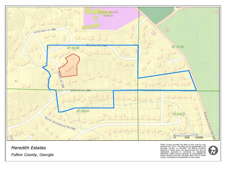
The land surrounding Meredith House has changed through the years. From the time Ken Meredith bought his original parcel from the Blantons through 2010, the land ownership has changed frequently. Here are a few GIS maps to illustrate the changes.
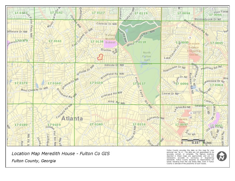
For perspective, the area is about a quarter of a mile to the west of Chastain Park, Atlanta, Fulton County, Georgia.
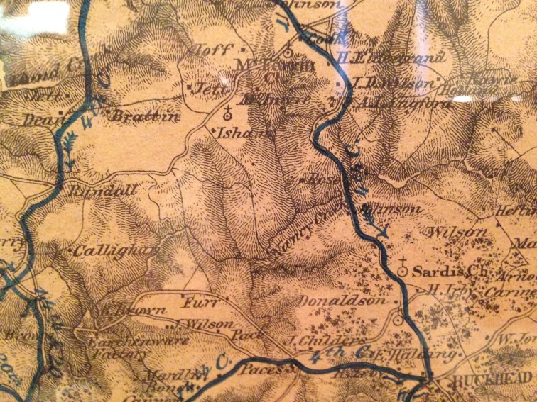
Prior to the property being owned by the Blantons, the Vaughans and others owned the land. At least one map from during the Civil War shows “Rose” with a residence located in a nearly identical location to Meredith House.
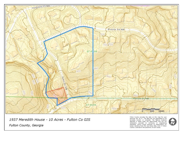
Ken Meredith purchased about 10 acres from the Blanton estate. Based on the title boundary description, the lines above represent this purchase.
A 1938 Fulton County Plat Map book shows a pencil outline of some property that may have represented the Merediths’ original land purchase.
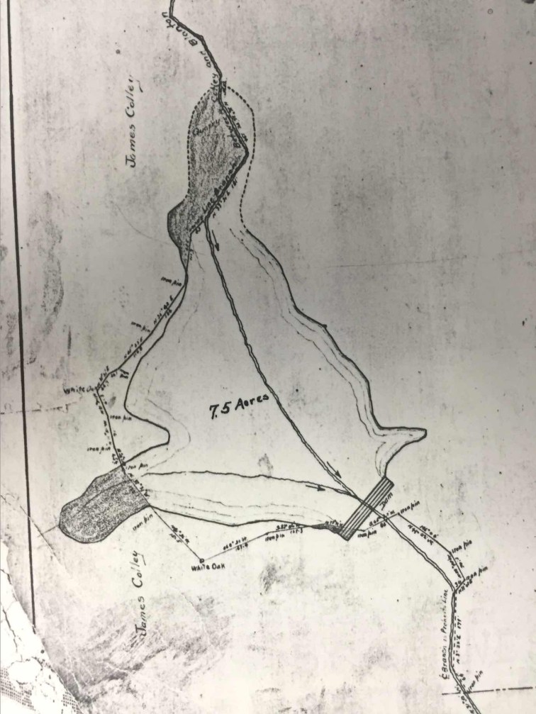
In the original 1937 deed is reference to having rights to access the lake the Blantons intended to build. The Blantons had rights to build a dam and flood certain land to an elevation of 850 feet. The map below represents the proposed lake shoreline.
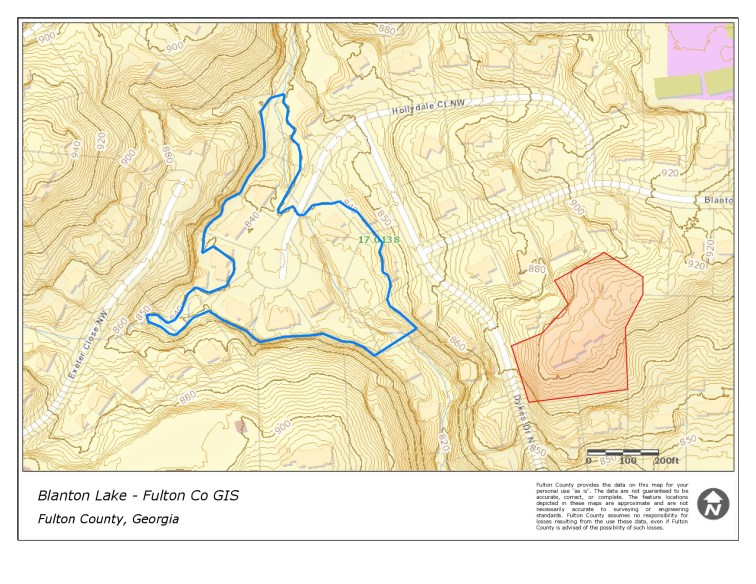
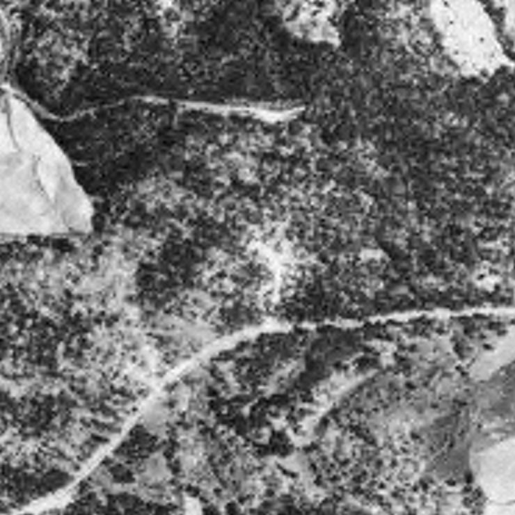
This lake would have provided over 50 feet of shoreline to a lake. The Merediths had the right to use the lake and build and dock. The Blantons cleared the land to build the dam as evidenced by aerial photos from 1938 (the cleaning to the left of the image frame is the proposed lake bed). Below is a partial copy of Fulton County Plat Map Book 15, page 48, which shows the proposed 7.5 acre lake and dam. The map is dated June 1930.
There is an absence of old-growth trees on the cul-de-sac by Hollydale Court. For some reason, the dam was never completed. The lake never came into being.
Following the original 1937 purchase, multiple parcels of land was later acquired by the Merediths as shown below. The expansion added about thirty acres to the original land. This land was to the eastern end of the estate. In addition, the Meredith’s purchased a number of acres on the south side of Hillside (currently known as 340 – 440 Hillside Drive). These lots are known as the Hazel L. Meredith Subdivision on deeds. This land acquisition also explains Lynn Meredith’s comment that her father, Ken Meredith, would go hunting across the street (i.e., Hillside) in the 1940s. This area was rural but was just north of the Tuxedo Park Development.
Based on a Fulton County deed title search, the Merediths compiled over 40 acres of land holdings on both the north and south side of Hillside Drive prior the end of World War II. The map below represents the peak holdings based on deed records. The Merediths had over 2500 feet of frontage on the north side of Hillside Drive, over 1700 feet of frontage on the south side of (the proposed) Blanton Road, 1000 feet of frontage on the south side of Hillside Drive, and about 380 feet of frontage on the west side of Powers Ferry Road. In 2016, the land holdings are represented by over fifty residential lots.
In 1952, the City of Atlanta annexed over 50,000 acres and tripled the six of the city.
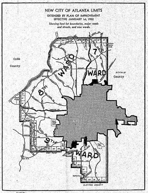
This annexation absorbed the Meredith’s land.
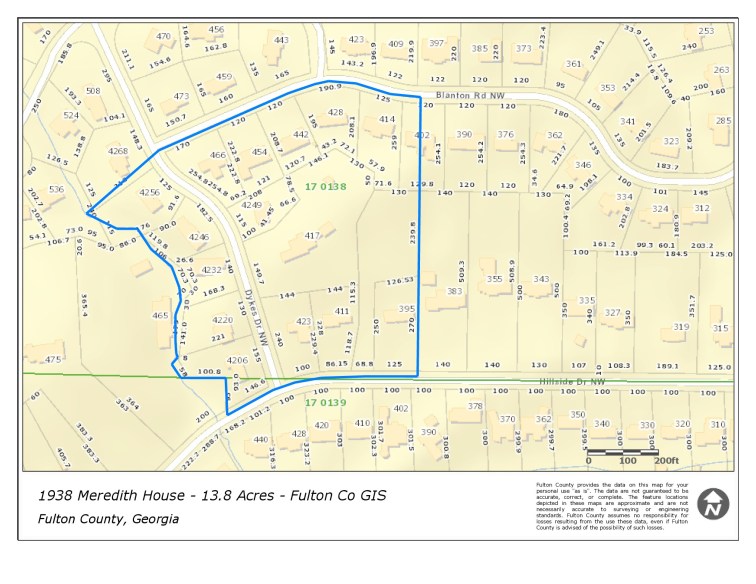
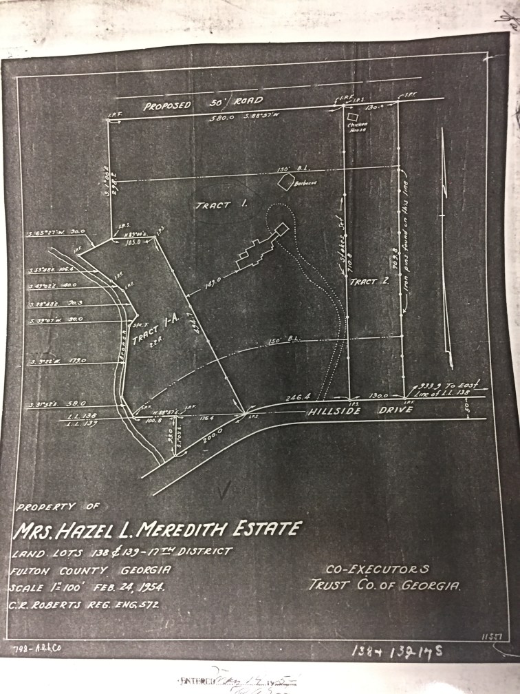
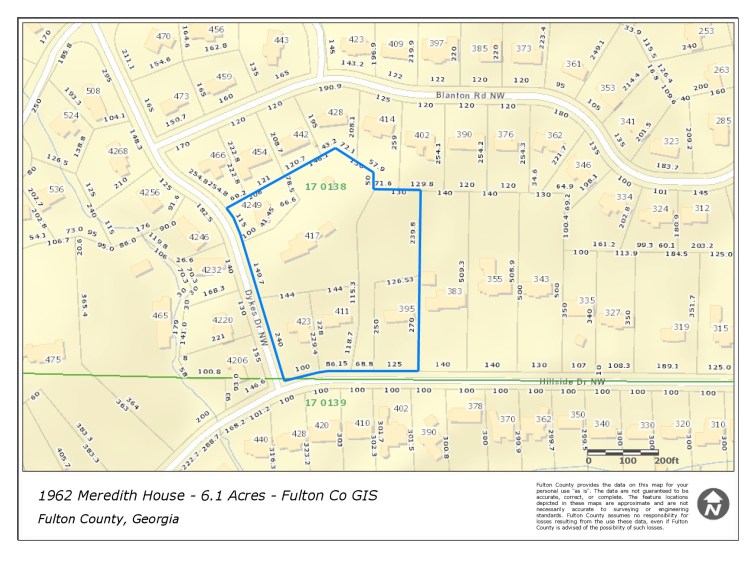
The 13.8 acres represented above was the land transferred to the McLoughlins in 1954 and remained intact through 1962.
After the passing of Dr. & Mrs. McLoughlin at Orly, the land flowed into their estate and a trust. Somewhere during the second half of 1962, land was carved off from the 13.8 acres to build Dykes Drive (now known as Tuxedo Forest Drive), five additional residential lots on the western side of Dykes Drive, and five additional lots on the south side of Blanton Road. Dykes Drive and Blanton Road were new streets. Dykes Drive may have been taken by the City of Atlanta.
By the time Meredith House was sold to the Leachmans in late-1962, the land surrounding the house had been reduced by more than half.
The Leachmans sold the residence and land to the Workmans in 1964. Between 1964 and 1973, the Workmans sold four additional lots (three fronting Hillside Drive and one on Dykes Drive). The residence then sat on approximately 3.5 acres from 1973 through 2007.
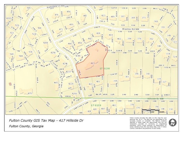
The Thompson estate sold the residence and 3.5 acre lot to the Fenders. The Fenders also purchased 4249 Dykes Drive. A total of 4 acres was compiled. The land was renamed Hillside Estates. The intention was to subdivide the property. A plan was approved by the city to subdivide the property into five lots after razing Meredith House, removing 183 trees, and hauling off nearly 9000 cubic yards (about 1500 dump truck loads) of dirt.

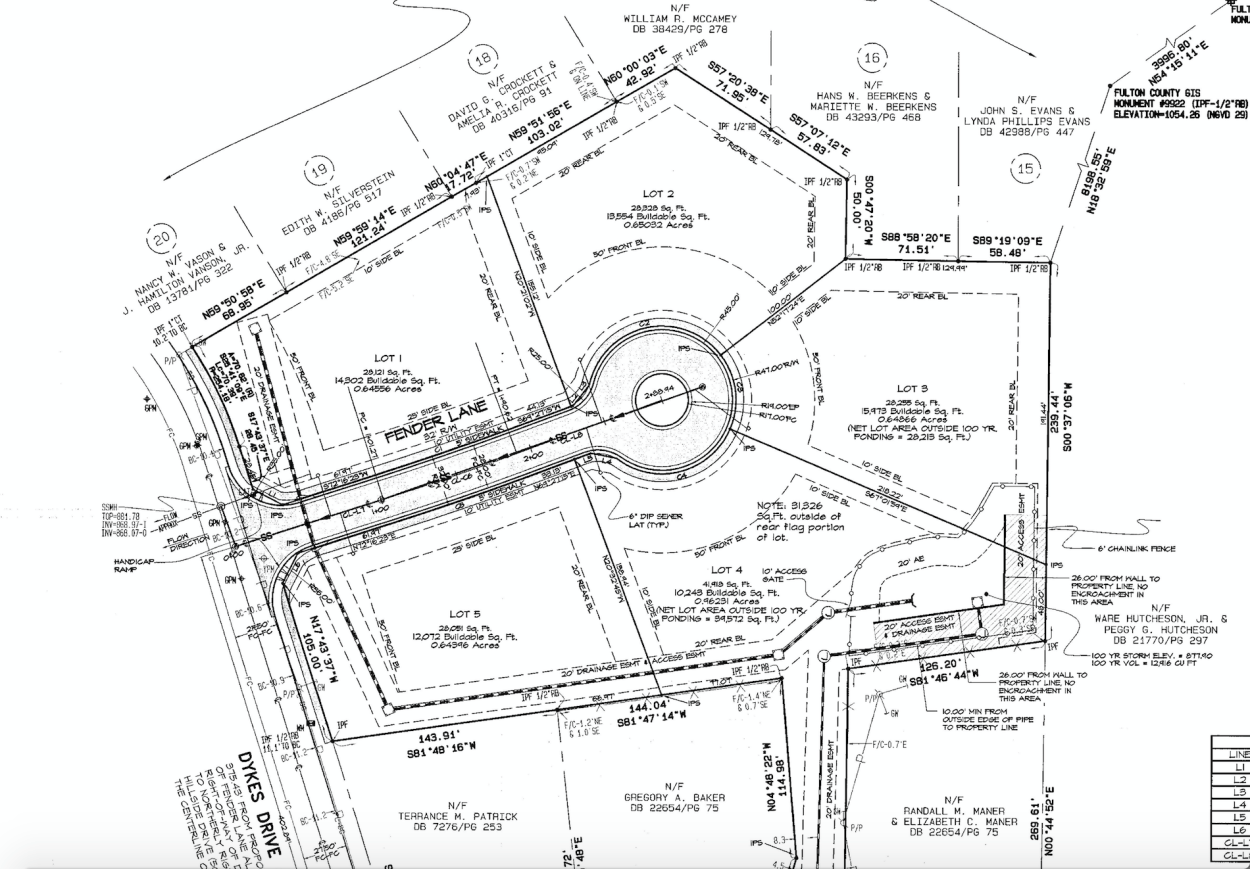
Ultimately, the plan to demolish the house never materialized. Instead, the lot at 4249 Dykes was reconfigured and reduced in size. The lot at 417 Hillside was subdivided into two lots. Meredith House remained on about 2.3 acres and had majority frontage on Dykes Drive (known as 4235 Dykes Drive) and another 1.2 acre “flag” lot retained Meredith House’s driveway and some woods (known as 399 Hillside Drive).
The current owners retained possession of both 399 Hillside and 4235 Dykes Drive. This constitutes the land owned by the Thompsons from 1973 through 2007, which is about 3.5 acres.